Texas Drought 101
Got a Question about Drought?
The Three Types of Drought
As a drought persists, the conditions surrounding it gradually worsen and its impact on the local population gradually increases. People tend to define droughts in three main ways:
- Meteorological drought is brought about when there is a prolonged time with less than average precipitation. Meteorological drought usually precedes the other kinds of drought.
- Agricultural droughts are droughts that affect crop production or the ecology of the range. This condition can also arise independently from any change in precipitation levels when soil conditions and erosion triggered by poorly planned agricultural endeavors cause a shortfall in water available to the crops. However, in a traditional drought, it is caused by an extended period of below average precipitation.
- Hydrological drought is brought about when the water reserves available in sources such as aquifers, lakes and reservoirs fall below the statistical average. Hydrological drought tends to show up more slowly because it involves stored water that is used but not replenished. Like an agricultural drought, this can be triggered by more than just a loss of rainfall.
Care about Texas Water Issues? Click here for the Texas Water Calendar.

Current Texas Drought Conditions
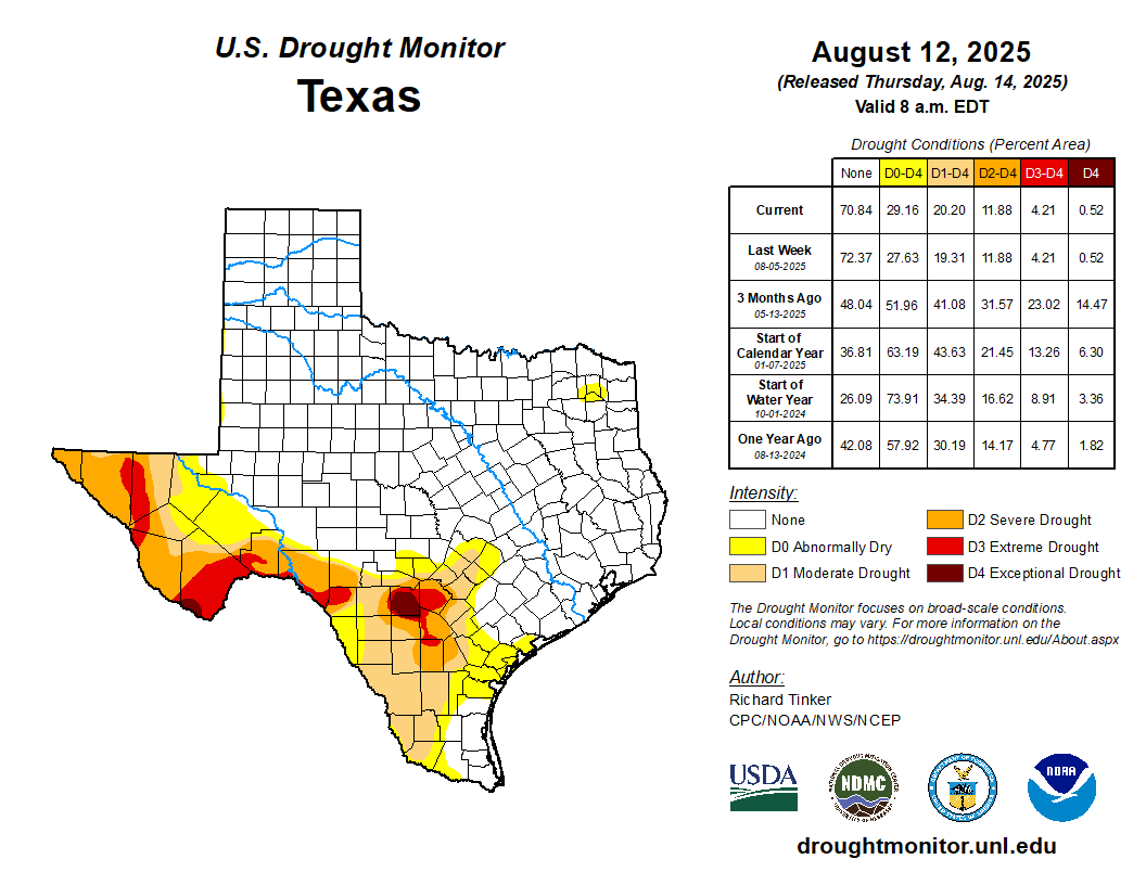
Texas Drought: 2000 to Present

SOURCE: National Drought Mitigation Center (NDMC), the U.S. Department of Agriculture (USDA) and the National Oceanic and Atmospheric Association (NOAA).
Current Texas Reservior Conditions
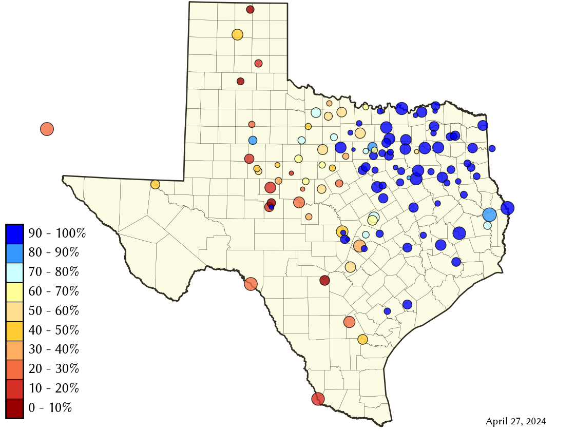
SOURCE: Water Data for Texas, Texas Water Development Board (TWDB)
Texas Public Water Systems Affected
SOURCE: Texas Commission on Environmental Quality (TCEQ)
Texas Current Burn Bans by County

SOURCE: Texas A&M Forest Service. Burn burn RSS feed also available.
Daily Water Readings from Central Texas Aquifers and Streams
SOURCE: Edwards Aquifer Authority (EEA)
LCRA Hydromet Data System

The Lower Colorado River Authority (LCRA) of Texas operates and maintains a Hydromet network of 265 remote stations over an area of roughly 18,000 square miles in central and southeast Texas. The network supplies hydrological information on river stages, lake levels and streamflows. It also displays meteorological information including rainfall, air temperature and humidity. The gauges are equipped with a small computer designed to operate in harsh conditions and radio equipment to transmit the data over LCRA’s 900-megahertz radio towers.While the website shows a variety of data, the rainfall totals data is particularly useful. It can show you the amount of rainfall that fallen over the lower Colorado River basin in many different increments including the past hour, past 12 hours, past 24 hours, past week, and the past 2 weeks just to name a few.